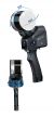


X120GO SLAM Laser Scanner. Accurate & Versatile
X120GO SLAM Laser Scanner with GoPost Processing Software
£19,500.00
In stock
SKU
X120GO SLAM Laser Scanner
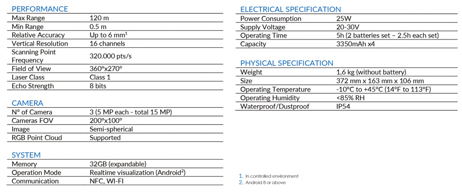
The system has a 360° rotating head, which can generate a 360°x270° point cloud coverage. Combined with the industry-level SLAM algorithm, it can obtain high-precision three-dimensional point cloud data of the surrounding environment without light and GPS. Equipped with three 5MP cameras to generate a 200°FOV horizontal and 100°FOV vertical, capable of synchronously obtaining texture information and producing colour point clouds and partial panoramic images.
X120GO can use GOapp to check and manage projects which will be updated and displayed synchronously. Real-time SLAM mapping and preview can be achieved via GOapp.
GOpost can perform post-processing of collected data, generate high-precision and high-definition color point clouds, produce partial panoramic images, display point cloud and perform optimization processing.
X120GO has an integrated structure design with a built-in control and storage system and built-in replaceable lithium batteries. Once pressed the start button, X120GO can start operations immediately, making data acquisition more efficient and convenient.
You can manage your point clouds in the office with our Cube 3D and Stonex Reconstructor (contact us for pricing) Software or, if you need something different, you can use PointCab (Ask for more details/price). Thanks to the collaboration between Stonex and PointCab, you can process X120GO data with it.
-
RAPIDITY AND REDUCED WORKLOAD
No more multiple scan station, just move around the scene to collect the entire 3D point cloud, without time-consuming cloud to cloud alignment. Download the full data right after the capture.
FLEXIBILITY
Combine indoor & outdoor data, even in the most demanding environments.
REAL TIME PREVIEW
± 5 degrees tilt supplement angle for precise leveling. A 360° one-stop scan requires only 45s.
AUTOMATIC CONTROL POINT MEASUREMENT
When capturing data, X120GO is able to collect reference points too. They can be matched with known control points to georeference the scans.
INTEGRATED CAMERAS
Three integrated 5MP cameras are able to cover the wide field of view of the scanner, obtaining coloured point cloud and panoramic images.
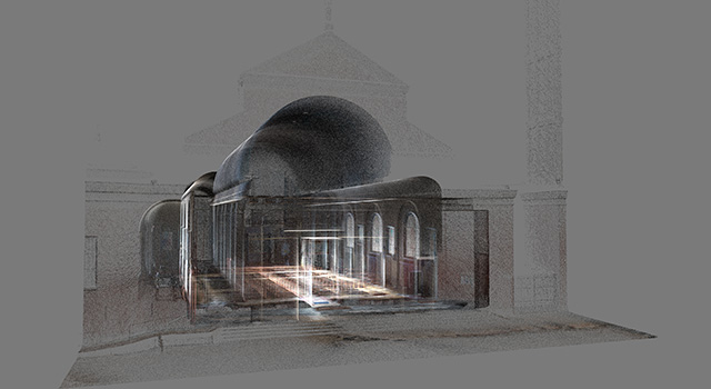
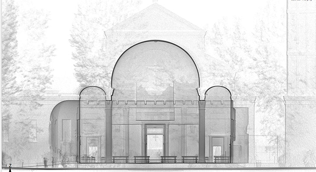
Data Examples: